Historic California Posts, Camps, Stations and Airfields
El Castillo de Santa Barbara
by Justin Ruhge
 
 
While it is known that the Santa Barbara Castillo was built, there is not the same correspondence in the official records about it that we find for the other three Castillos. The cost or the designs are not known except by the record of the other Castillos and a drawing by DuFlot de Mofras.

And as in the other Castillos there is a comment from Vancouver that pertains to the Castillo at Santa Barbara published in Vancouver in California 1792-1794 Vol. I, pg. 241, as follows:
"Santa Barbara is a post of no small consequence, and might be rendered very tenable, by fortifying a hill conspicuously situated for such a purpose on the north-west side of the roadstead; yet they have here only two brass nine-pounders, placed before the entrance into the Presidio, which is situated in the valley or plain beneath, at the distance of about a mile from this eminence. As this post is the key to all the communication between their northern and southern establishments, it was worthy to remark, that they had not attempted to provide roads…"


Bancroft stated in The History of California, Vol. I, pg. 666, the following:
"Having no fort, Santa Barbara obtained no part of the reinforcements of artillerymen and infantry sent to California in 1796, and was garrisoned by cuera cavalrymen only. The annual appropriation for this presidio from the royal treasury did not vary much from $15,000."


In 1796, as seen earlier, the royal engineer Alberto Cordoba arrived in California to inspect the fortifications and to make recommendations for improvements. In September 1796, Cordoba describes a situation at the three Castillos to Viceroy Marques de Branciforte. He does not mention the Santa Barbara Castillo and it must be assumed that it does not exist at that time. While Vancouver felt it would be a good idea to place a fort on the high ground northwest of the town, we must conclude that, as in the case of the other Castillo, Cordoba did also. In a letter to the new Governor, Borica, Cordoba describes his efforts to complete a map of Alta California as well as plans of the new batteries at Yerba Buena, Santa Barbara and San Diego. These letters are prepared at Monterey on September 30 and November 26, 1797 and are located in the California Archives folio 14. The plans have never been located to date. It is most probable that the Castillo at Santa Barbara was constructed or started before Cordoba left California in October 1798, but the official record is silent on this subject. Cordoba returned to Mexico where he continued a brilliant career as an engineer and architect until his death in 1814 at the age of 73.
 
The historic record jumps to 1829. Alfred Robinson, who has already been mentioned in the discussion of the Santa Barbara Presidio, included a drawing of the town of Santa Barbara in a front piece of his book Life in California that was drawn in 1829 "from a hill near the Castillo". This drawing is shown in the earlier section under the Santa Barbara Presidio. Robinson further states on page 62, "And on the left of the town (Santa Barbara), in an elevated position, stands the Castillo, or fortress." Robinson's book was a life history, which was not published until 1846. Why there is no record or comments from others between 1797 and 1829 is puzzling.


The Castillo Shown as a Chevron by Eugene DuFlot de Mofras, in 1843. In Travels on the Pacific Coast.

 
The next reference appears in the published work of Eugene DuFlot de Mofras who describes his visit to Santa Barbara in 1843 in his Travels on the Pacific Coast by Marguerite Ayer Wilbur. In Vol. I, pgs. 167, 192 the following statements are made:
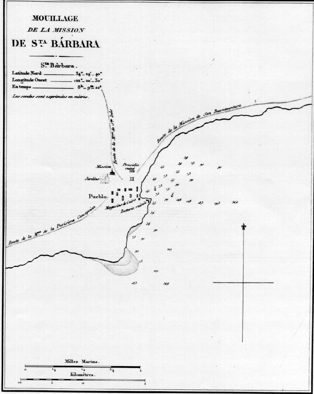
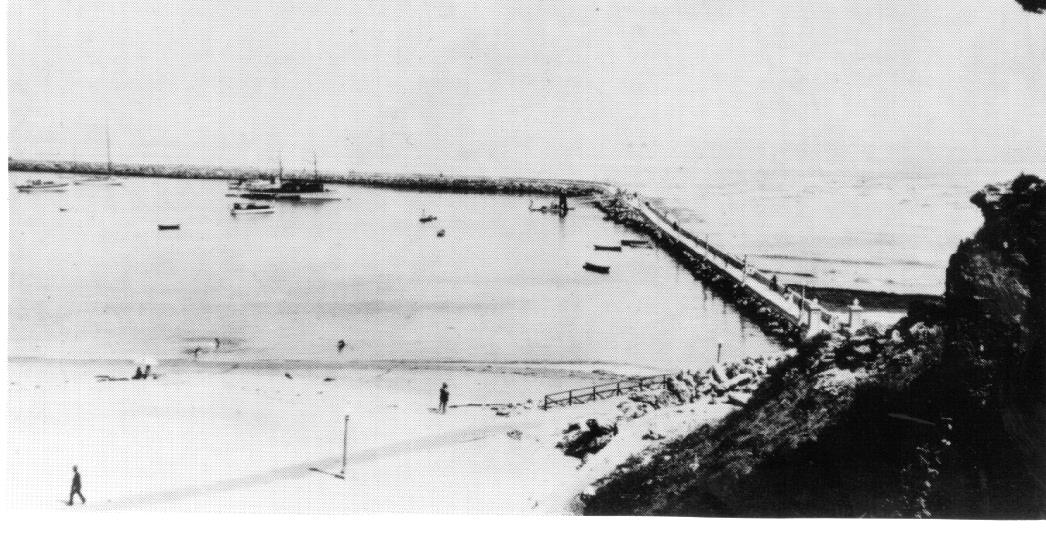
"At Santa Barbara, the garrison at the presidio, which is now in ruins, includes a dozen soldiers in command of four officers. Four bronze pieces lie buried in the sand. A small point on which was once situated the ancient Spanish battery which is now razed."


The "four bronze pieces" may refer to the cannon at the Castillo. More importantly, as with the other California locations, DuFlot de Mofras included a map of Santa Barbara in his publication, which clearly depicts the Castillo as a chevron in shape and refers to it as "Batterie ruinee". So in this one reference, we learn that the battery or Castillo did exist and its shape. The Castillo is located about where Vancouver recommended it to be and this is on a point, which had a good view of the roadstead in front of Santa Barbara. The shape is logical for the location and the construction is probably very similar to the other Castillos described earlier. In earlier Spanish maps, this point was designated as Point Martinez after the captain in charge of the survey expedition on the frigate Princesa during the founding of the Santa Barbara Presidio in 1782.

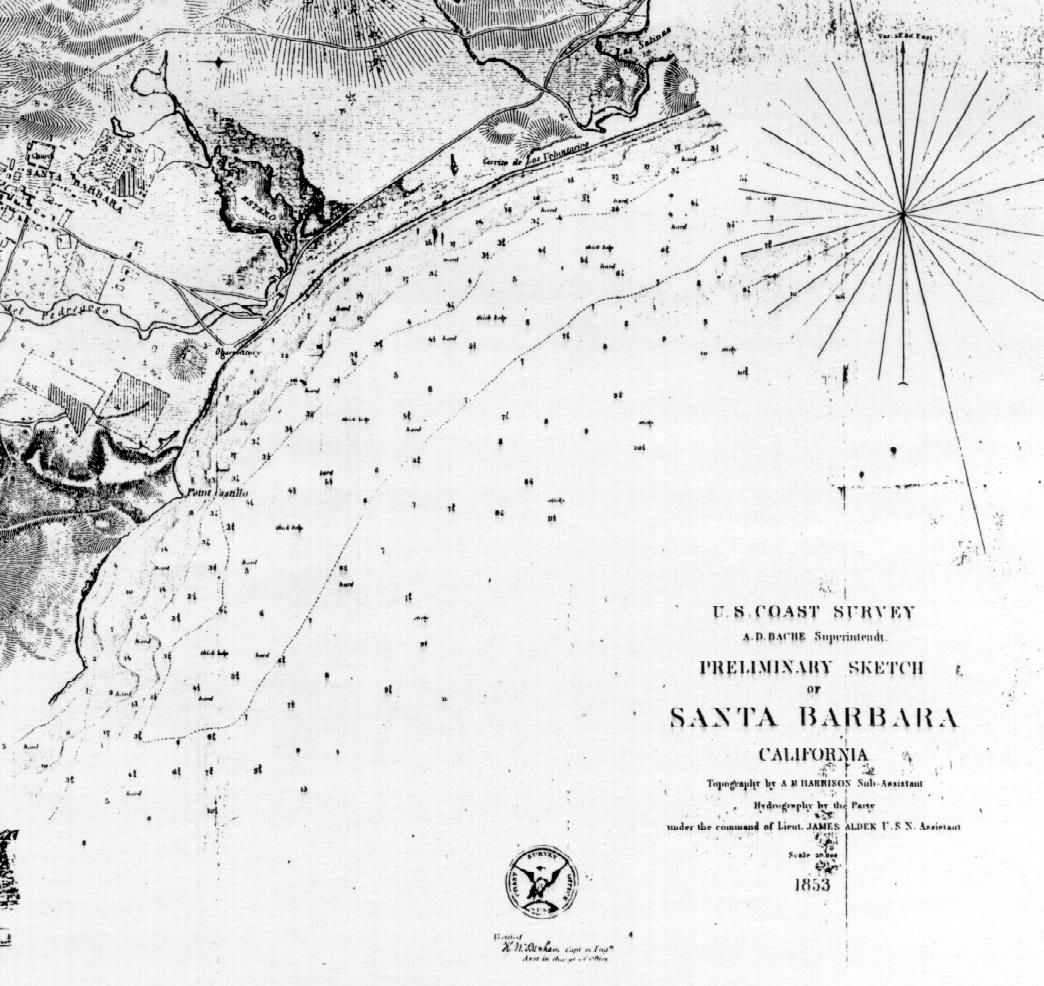
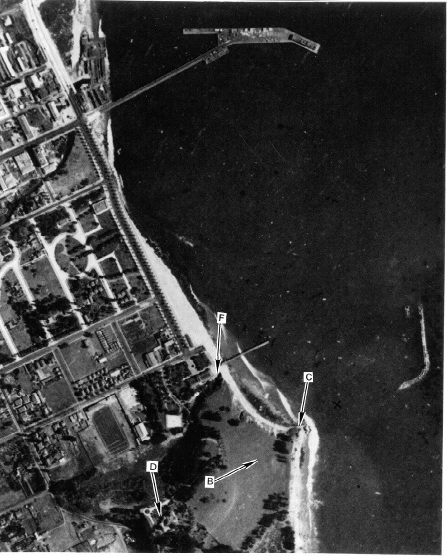
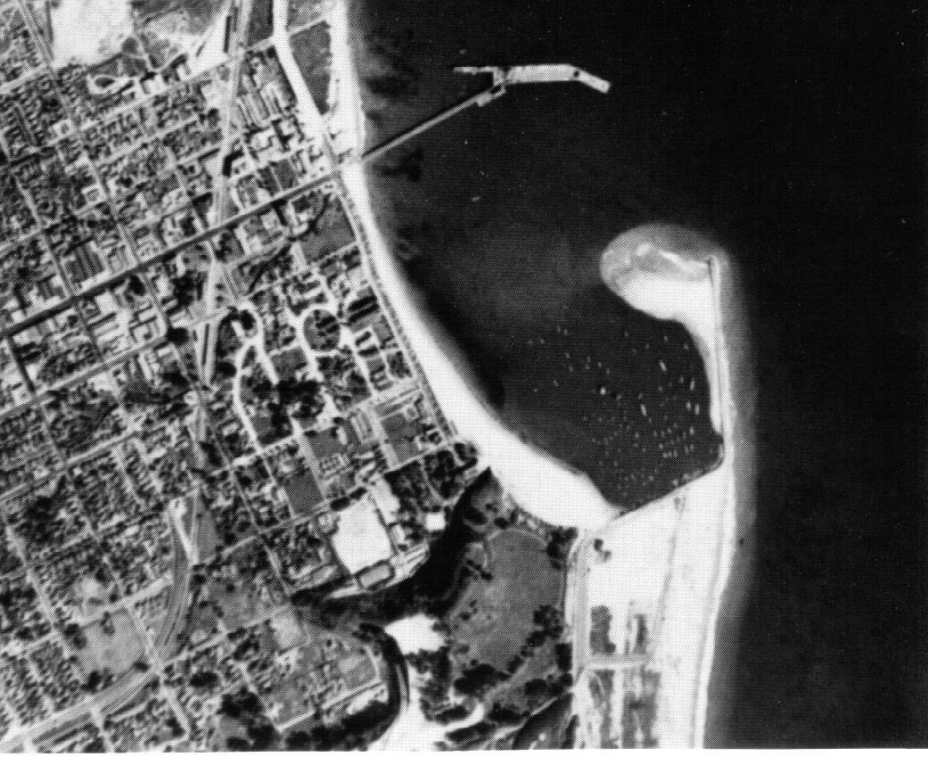
In 1853, the U.S. Coast Survey made its first map of Santa Barbara after the conquest. It also identifies a "Point Castillo" at the place indicated by DuFlot de Mofras.
 
A. M. de la Guerra makes another reference to the Castillo in 1864. His comments are located in the Jose de la Guerra Papers at the Mission Archives, Santa Barbara in page 228. There he is referring to the wreck of the Pride of the Sea on the coast. He states as follows:
"Captain Garcia's boat went aground on the other side of the castle and now they are unloading the cargo, which it is believed can be saved somewhat. The boat was lost forever."


This location is near the present day lighthouse. The "castle" referred to here is the later word used for the "Castillo".
 

The American Army took possession of the Presidio and Castillo in 1847. An article in the Santa Barbara Daily Independent on April 6, 1892 describes what they found as follows:
 
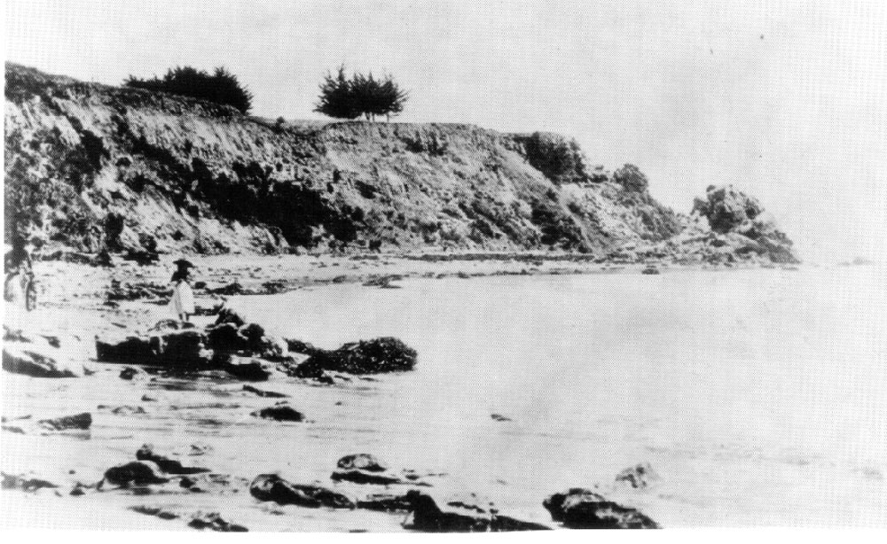
"This "Punta del Castillo" which is really the outward point of the fortification, in English, marks the place where formerly stood an old Spanish earthwork fortification or fort. In the early days when Americanos came to California there were mounted three old iron six or nine pounders whose muzzles looked out to sea in a threatening manner. This spot was then known as "El Castillo." For years it stood alone and unguarded. The fingers of time touched it more and more till nothing was left but the old guns - dangerous to only those who discharged them - and later even these were removed. Then came into use the name it now bears, "La Punta del Castillo" which signifies the place where the castle or fort stood. In the year 1847 when Capt. Henry Carnes, John Scollan and Thomas S. Martin - all members of the U.S. Army, were new comers in Santa Barbara there was no depression between the bluff and what we now call Castle Rock. Then one could pass from the bluff where the fort stood to the rock with no trouble."
Another more distant reference to the Castillo occurs in Early Days of Santa Barbara by Walter A. Hawley published in 1910. In it he is describing the local preparations for the impending Bouchard attack in 1818, on page 64. The account is as follows:
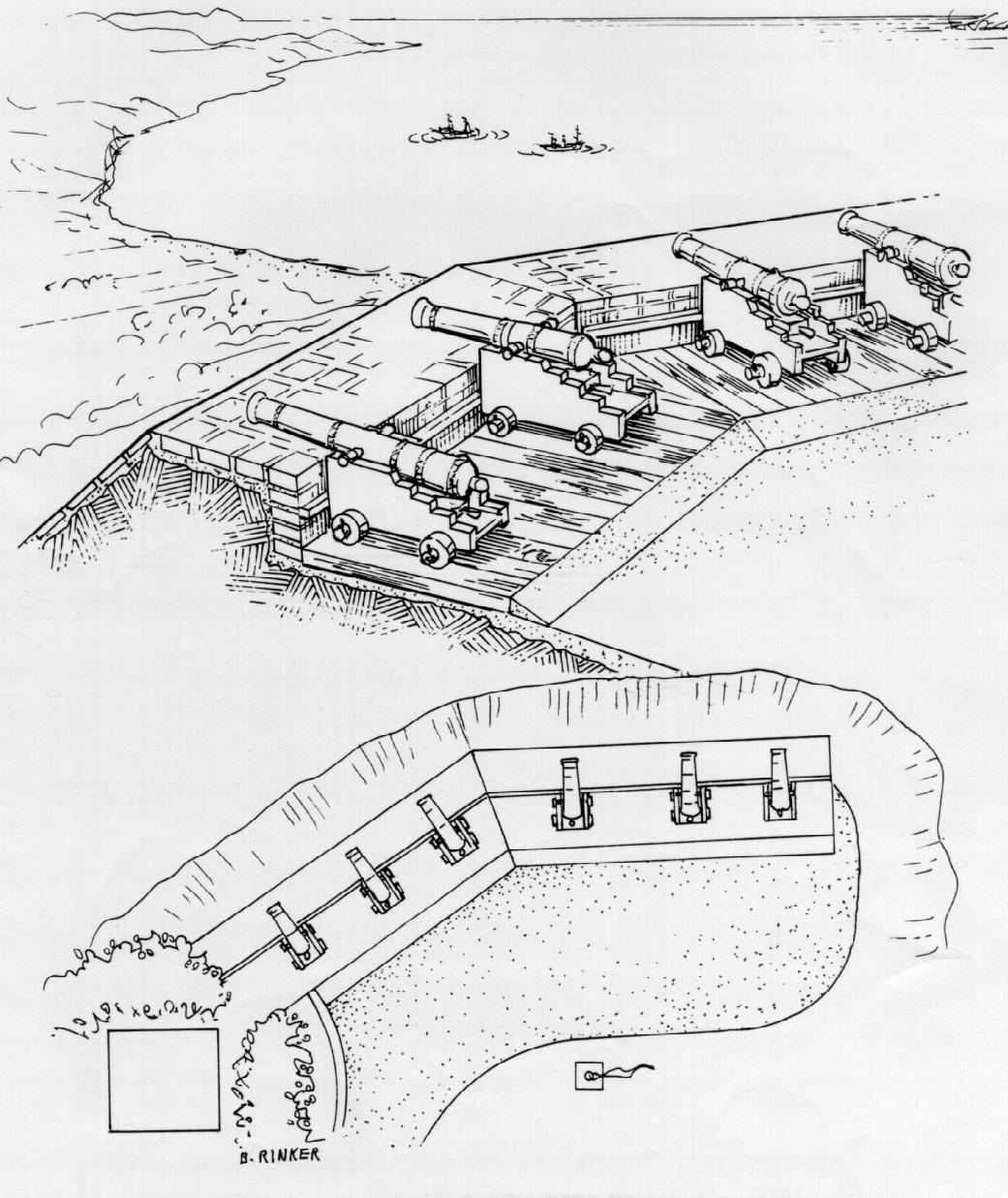
"Father Ripoll, the superior of the Santa Barbara Mission, organized an Indian force of one hundred and eighty men to cooperate with the soldiers of the presidio; but as the Indians were untrained and as the few small guns of the presidio, and of the Castillo on the Mesa, would be of little avail in opposing the armament of the two vessels, orders were issued that the women and children should be prepared for flight to Santa Ynez."
 
Hawley had researched the Presidio history and made current drawings of it in 1898. In the same way he may have inspected the Castillo so in making the comments in his book, he had first hand knowledge of both. The implication in his comments is that the Castillo was in existence before 1818.
 
In 1926, David Banks Rogers, in association with the Santa Barbara Museum of Natural History, undertook a survey of the Native American sites along the coast in Santa Barbara County. His findings were published in 1929 in his book Prehistoric Man of the Santa Barbara Coast . One of the places he inspected was the village of "Mispu" or "The Place of the Hand" located at the present day City College soccer field and, it turns out, the site of the Castillo. On page 111 of this publication the following comments are made:


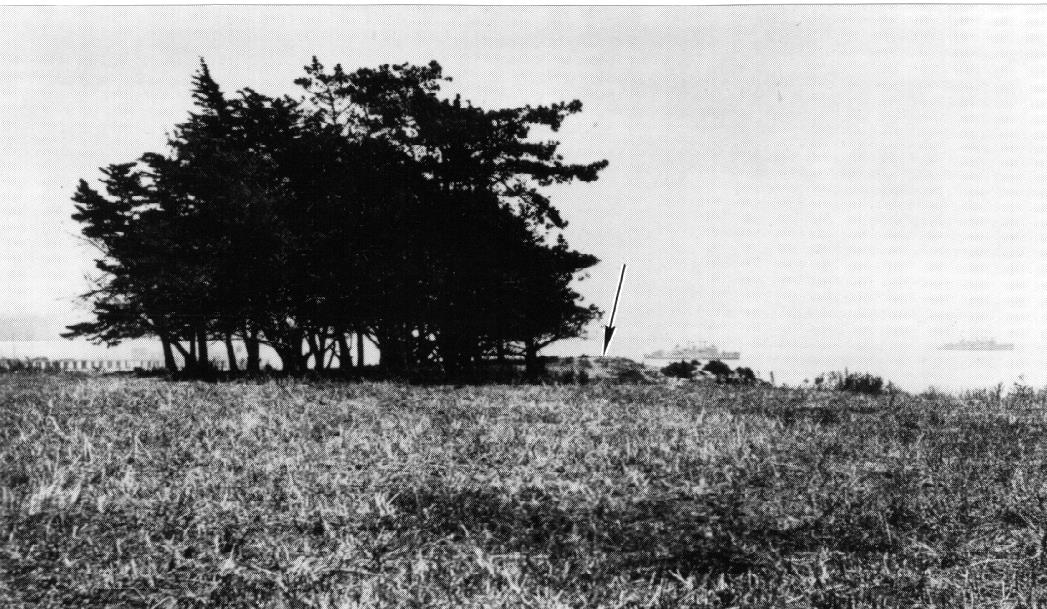
"I was unable to obtain permission from the owners to explore this site. Superficial survey showed that a dense bed of camp refuse covered a wide area at the brink of the cliff. At the eastern extremity of this deposit, one can trace the outline of the Spanish redoubt that once guarded the harbor. About three hundred yards to the north of this "Castillo" are the indications of another but less extensive rancheria site on slightly higher ground."
 
 
The Castillo was still visible in 1929. J.P. Harrington was an associate of Rogers. He was working with the Museum of the American Indian in New York. On January 29, 1924, the Santa Barbara News Press described his work in recovering artifacts at "Mispu" on Castle Rock Point. Two excerpts are as follows from this article:

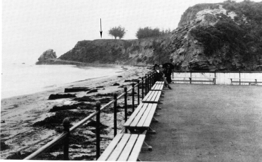
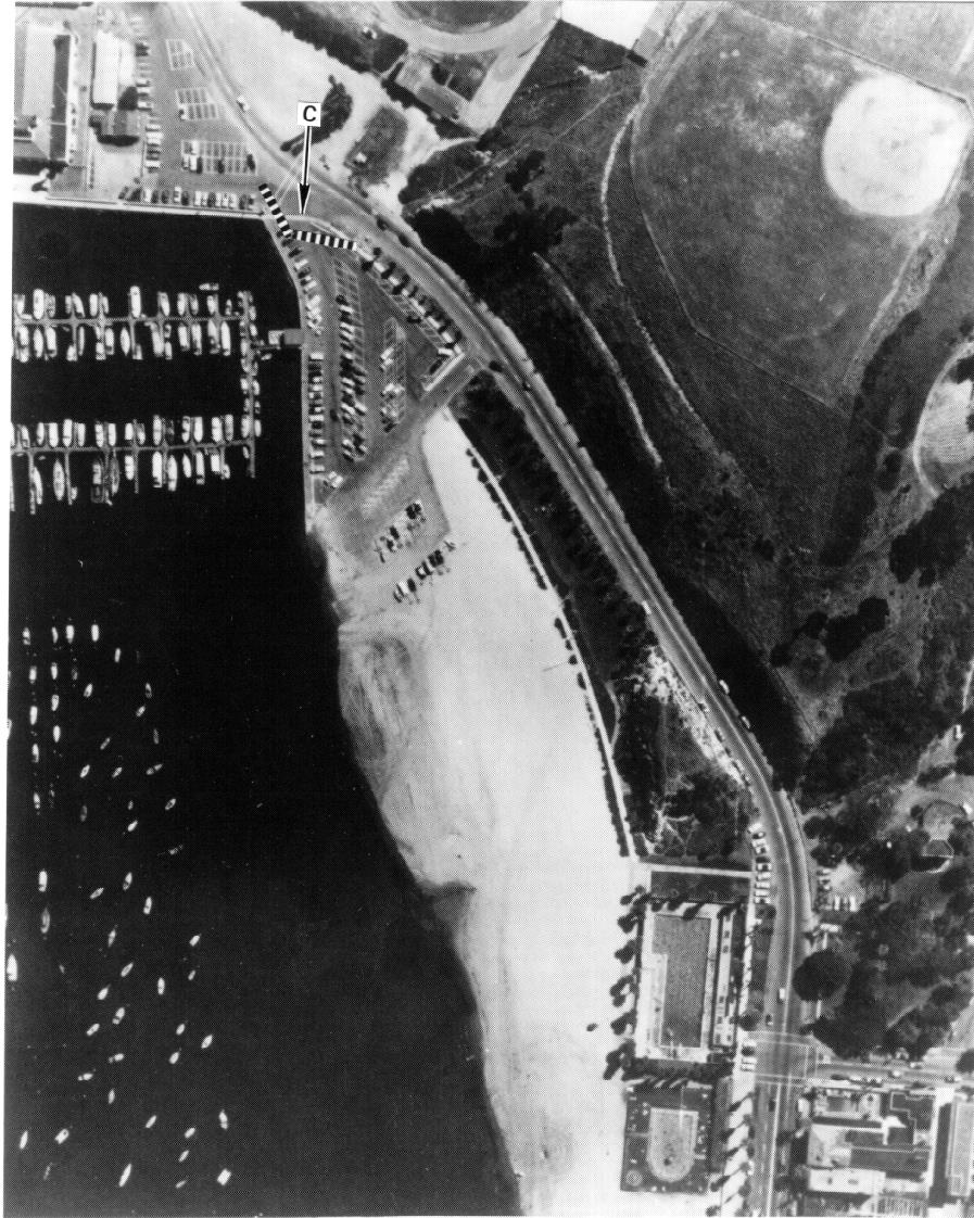
"Straight back from the point where the Spanish fortress stood about 1,200 feet, is the old Indian graveyard in the center of what was formerly Leadbetter's polo field. Mr. Harrington also obtained a cannon ball of the old fortress, which was found by Charles T. Hall, 105 Bath Street in 1871. Some of the mortar work of the old fort was still standing at that time. The point was formerly named La Punta de Castillo, according to Mr. Harrington, deriving its designation from the fortress which was built there as a part of the defense of the old Presidio Santa Barbara."
 
The Castillo was built with brick and mortar as were the other three Castillos. This material was still visible in 1871.
 
The U.S. Coast Survey Map of Santa Barbara made in 1853 showing the town and in the middle left the Point Castillo. Courtesy of the National Archives.


An 1877 drawing of Santa Barbara showing the Castle Rock location at "C" and the Fossil Rock location at "F". The hole on the right is where a mouse ate through the drawing while it was stored. The pile of rocks to the right of Point "C" was referred to as Castle Rock before it was blown up to make way for the new breakwater. Courtesy of the Santa Barbara Historical Society, Santa Barbara, California.
 

The author has located several photographs that show the remains of the Castillo. Shown is Fossil Hill, below and to the east of City College where the beach has long been an area used by local bathers for water and sea sports. At this point was once a promenade followed later by four indoor pools in a Victorian style bathhouse. Fossil Hill and this bathhouse were removed in the 1950s to make room for the present Los Banos outdoor pools and to extend Cabrillo Boulevard to the Mesa to the west of the breakwater and past Leadbetter Beach. With this group of photographs the remains of the Castillo can be seen. A part of the chevron has fallen into the ocean by this time due to erosion of the Castle Rock bluffs. In one photograph the remaining arm of the chevron is seen near a group of Monterey Pines.
 
In 1928 the first aerial photographic survey of Santa Barbara County was undertaken. In one of these photographs, the outline of the remaining arm of the Castillo is visible. To the right is the first breakwater of the Max Fleischman Harbor. In 1929 the breakwater was extended up to the base of the remains of Castle Rock. Castle Rock had been demolished about the same time because it was considered dangerous to the casual rock climber and also to make room for the new construction. In 1939 the latest aerial photographs show a beach filled in behind the breakwater, called Leadbetter Beach. The Castillo site has been cut into for the new road to the Mesa. In the next twenty years the entire hillside around the Castillo was removed to make room for the new parking at the harbor. In this way most of "Mispu" and the Castillo site were removed. The probable location of the Castillo relative to the entrance to the breakwater is shown by the dashed chevron shaped line on the last photograph.
 
Bud Rinker has created an artist's rendering of what the Castillo might have looked like. It is similar in construction to the other three in that an earth mound is covered with tile and brick and a wooden esplanade is laid down behind the berm so constructed on which the cannon can roll easily. Embrasures are not shown because there is no information to say that there were such things. A flagpole and a casa mata would also be a part of the Castillo.
 
The number of cannon originally at the site cannot be verified, but six to eight would not be unusual, based on the other Castillos. The type of cannon may have been bronze eight-pounders. Cannon at least this size would be needed to be effective over the range of the Castillo to the roadstead. The only reference that this author has found to cannon is the comment by DuFlot de Mofras - 4 brass cannon in the sand; and the comment of three iron cannon mentioned in the Daily Independent, already stated above. None of the cannon mentioned in early Santa Barbara records survive today.
 
Today there is nothing left of the Castillo except this record! A bronze plaque identifies the location in a garden on the City College Campus. In Santa Barbara, Castillo Street recalls the existence of the historically "silent" redoubt on the hill overlooking the roadstead.
 
 
References: for the Santa Barbara Castillo are as follows: Gunpowder and Canvas by Justin M. Ruhge; The History of California by H. H. Bancroft; The Spanish Royal Corps of Engineers in the Western Borderlands-1764 to 1815 by Janet R. Fireman; and others as noted in the above text.


In the upper picture "sun bathers" are standing next to Fossil Rock. Castle Rock is to the west, shown to the left of center. Note the schooner to the left of Castle Rock. The wheel tracks are from buggies that took the dirt road between the bluff and Castle Rock. In the lower picture the view is to the east with Castle Rock in the right center. Estimated period is the late 1890s. Courtesy of the Santa Barbara Public Library Photography Collection.
 
 
The same location about 1900 below Fossil Rock. A formal promenade replaces the sun bathers. Castle Rock is shown to the left center. The arrow points to theremaining berm of the chevron that was the Castillo. Courtesy of the Santa Barbara Public Library Photography Collection
 
 
The remaining berm of the Castillo is shown looking west from this view at the top of the hill. Castle Rock and the buggy road are Seen to the lower left in this view in About 1900. Courtesy of the Santa Barbara Public Library Photography Collection.


This view looks east and shows the berm of the Castillo in a group of trees, with the arrow. Note the size of the trees in comparison to those shown in the previous two photographs. In the background can be seen part of President Teddy Roosevelt's "Great White Fleet" that visited Santa Barbara in 1910. In the foreground is the "Mispu" burial grounds. This Site was inhabited by Native Americans before the Chumash and before the Spanish arrived at this location. Courtesy of the Santa Barbara Museum of Natural History Archives.


The first aerial photograph taken in 1928 showing the Castillo location. F) Fossil Hill, C) berm of the Castillo, B) The location on the hill of the "Mispu" Burial Grounds, and D) The Dibblee Mansion built in 1886 and sold in 1906 to Francis Leadbetter who developed a Polo Field on the "Mispu" Burial Grounds. Note the Victorian Bathhouse below Fossil Hill at the west end of Cabrillo Boulevard, and the first evidence of the Fleischman Breakwater on the right. The City College Administration Building stands today at the location of the Dibblee Mansion, which was damaged in the 1925 Earthquake and later demolished. Courtesy of the Santa Barbara County Antique Photography Collection.
 
 
The completed breakwater in 1930 shows the Fleischman Yacht in the background in the upper view and the debris of the Castle Rock on the far left of the picture which is looking to the east. The two pylons at the entrance to the breakwater are at the location of the Castillo. In the lower view, the pylons are seen from above and looking south. Courtesy of the Santa Barbara Public Library Photography Collection.


The aerial photograph of the harbor taken in 1939 shows the buildup of sand behind the breakwater and the removal of the Dibblee Mansion. The land is being cleared for City College. Courtesy of the Santa Barbara County Antique Photography Collection.


The aerial view of the Santa Barbara Harbor in 1957. Los Banos Pool replaced the victorian structure and Cabrillo Boulevard has been pushed through to Leadbetter Beach and the Mesa. C) marks the spot at which the Castillo once existed. The parking lot spread south and resulted in the removal of all the high ground between the road and the beach. Courtesy of the Santa Barbara County Antique Photography Collection.


El Castillo. A rendering by Bud Rinker of the probable design of the Santa Barbara Castillo. From Gunpowder and Canvas pg. 4-52 by Justin M. Ruhge.


A stone and bronze plaque in the Garden at City College which marks the approximate location of the Castillo. Photograph by the Author.
 
 
Search our Site!
Google
Search the Web Search California Military History Online
View My Stats
Visitors since 8 December 1998
Questions and comments concerning this site should be directed to the Webmaster
 
Updated 10 August 2017