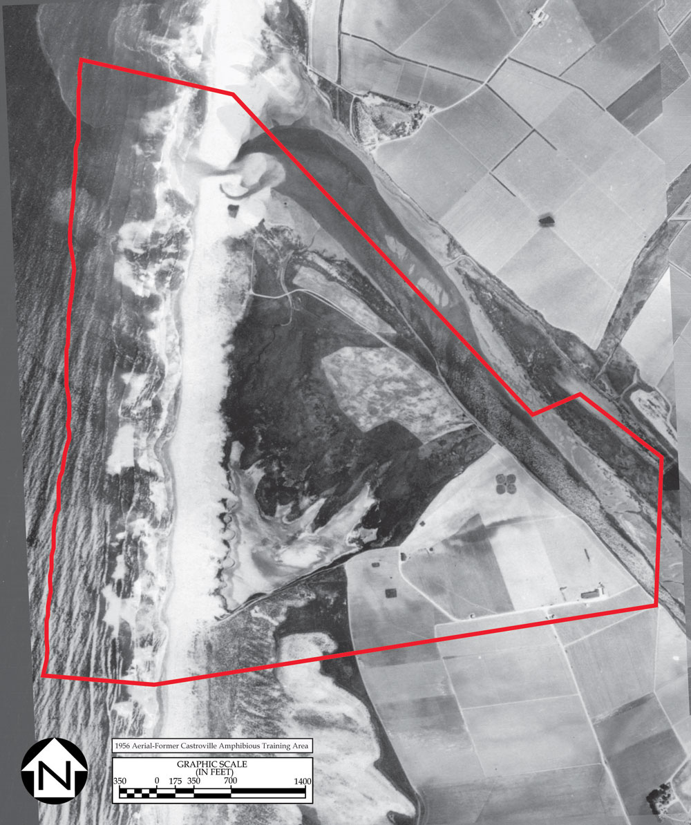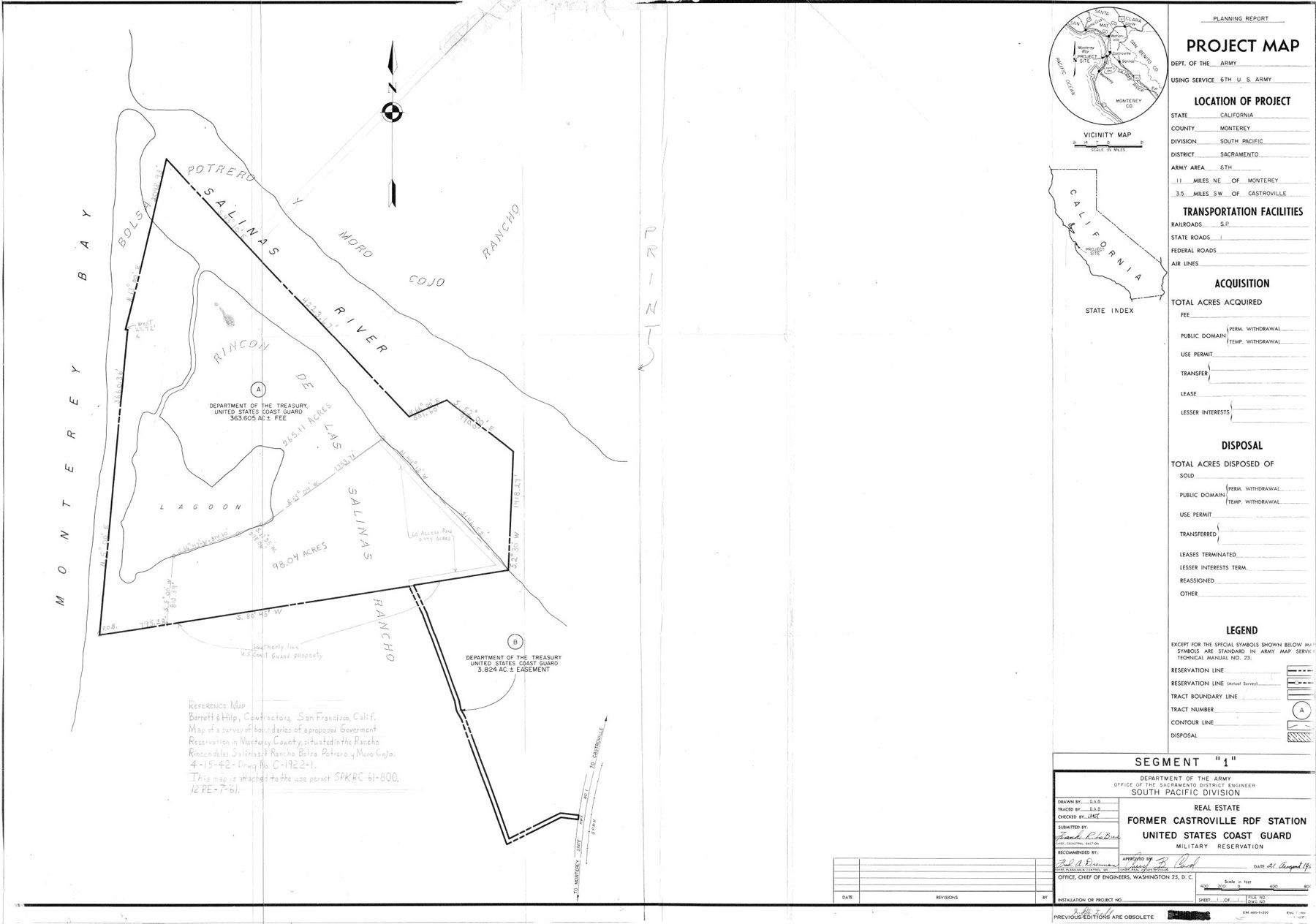

The site is on the central California coast, in Monterey County, 11 miles northeast of the city of Monterey and 3.5 miles southwest of the town of Castroville It is bounded on the west by the Pacific Ocean and on the northeast by the Salinas River.
On 15 September 1942, the Navy acquired by condemnation from Martin Estate Company, et al. 269.68 fee acres, 154.89 acres of submerged land, and 3.82 easement acres for a total of 428.39 acres. It was used as an amphibious training site, a radio direction-finder station, and as Bombing Target Number 8. Target Number 8 was established on 29 April 1944 as a subordinate activity of Naval Auxiliary Air Station, Watsonville, California. The Naval Radio Station was established in 1943. At some unknown time the station was transferred to the Coast Guard. In 1965, the Coast Guard transferred the total acreage to the General Services Administration (GSA). GSA transferred the total acreage to the Department of Interior, Bureau of Sport Fisheries and Wildlife on 27 June 1973. The site became the Salinas National Wildlife Refuge. The site is now managed by the California Department of Fish and Game under a cooperative agreement with the U.S. Fish and Wildlife Service
The Site was acquired by the U.S. Navy on 15 September 1942 from
the Martin Estate Co., et al, by means of the Federal condemnation
process. The purpose was to provide a new location for a naval
radio station that was located at Oyster Point in South San Francisco.
In March 1943, Naval Radio Station Castroville was officially
established at the Site. The purpose of the station was to host
fleet communication activities as well as radio direction finding
services.
Although not indicated in any documentation at the time, California law dictated that the adjoining 154.89 acres of submerged land was automatically ceded to the United States of America when the U.S. Navy acquired the Site. This tract of land does not appear on any real estate documents until the U.S. Army took possession of a portion of the Site in 1965.
In the 12th Naval District Public Works Office report, Physical Properties and Facilities of the Principal Naval Activities and Offices Located in the 12 ND, dated October 1945, the Site was shown to be able to house 40 sailors in a single wood-framed building that also had messing and recreational facilities and a small two-bed sick-bay. The site maps also show two other operational buildings, a combination storehouse and garage and other outbuildings.
On 29 April 1944, Bombing Target 8 was established in the northwestern portion of the Site as a training area for the nearby Naval Auxiliary Air Station (NAAS) Watsonville. The targets consisted of white rock circle 100 feet in diameter with a 10-foot bulls eye and a silhouette of a cruiser, 550 feet by 65 feet, superimposed on the circle. Research has not provided conclusive evidence of what type of ordnance was dropped on the targets. However, it was the standard practice to use 3-pound cast metal practice bombs, water or sand filled bombs, and spotting charges were used on similar targets within the 12th Naval District. Documentation could not be found in order to determine the exact period the bombing target was in operation. However, NAAS Watsonville was placed in an inactive status on 15 October 1945.
On 1 July 1945, the Site was transferred to the U.S. Coast Guard. At that time, the U.S. Coast Guard was part of the Navy Department having been transferred by executive order from the Treasury Department on 1 November 1941. The Site was renamed the U.S. Coast Guard Radio Direction Finding (RDF) Station Castroville and dropped from the July 1945 edition of the Public Works of the Navy Data Book. The U.S. Coast Guard was transferred back to the Treasury Department on 1 January 1946 (www.uscg.mil). A 22 October 1947 U.S. Coast Guard memorandum indicated that by that time the RDF Station wad been placed into a "Caretaker" status in which the buildings, grounds, and equipment were minimally maintained but not operated.
On 14 May 1958, the U.S. Coast Guard reported to the General Services Administration (GSA) that the Site was in excess to that service's needs. However, GSA records on file at the National Archives in San Bruno, California indicate that they took no actions to dispose of the site at that time.
On 15 June 1961, the U.S. Coast Guard permitted
the U.S. Army 206 acres to test and train on amphibious logistical
vehicles called BARCs (Barge, Amphibious, Re-supply, Cargo) and
later LARC-XLs (Lighter, Amphibious, Re-supply Cargo, 60-ton).
These vehicles were designed to take as much as 60 tons of cargo
from a ship off-shore and transport it over the shore and further
inland (Figure 3 1). On 2 February 1965, the U.S. Coast Guard
formally transferred 428.39 acres, including the 154.89 acres
of submerged land, to the U.S. Army. That portion of the Site
was renamed as the Castroville Amphibious Training Area and became
a sub-installation of Fort Ord, California.
On 27 June 1973, the U.S. Army transferred its portion of the
Site to the Bureau of Sports Fishing and Wildlife of the Fish
and Wildlife Service, Department of the Interior to establish
the Salinas River National Wildlife Refuge. According to the Salinas
River National Wildlife Refuge: Comprehensive Conservation Plan
published by the Fish and Wildlife Service in December 2002, the
U.S. Coast Guard conveyed its remaining 93.93 acres to the same
agency during that same year.
The U.S. Coast Guard used the Site as an
RDF station. From 1947 until it was transferred to the Fish and
Wildlife Service in 1973, the station was in an inactive status.
The Site, made up of the former RDF Station and the U.S. Army's
Castroville Amphibious Training Area, is now the Salinas River
National Wildlife Refuge under the control of the Fish and Wildlife
Service, Department of the Interior.


Sources: Site Map, Direction Finding Station, Castroville, 8 May 1942; General Services Administration (GSA) Standard Form 118, dated 14 May 1958.