Historic California Posts, Camps,
Stations and Airfields
Corn Springs Gap
Filler Annex SM-162B
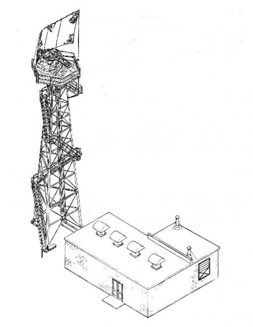
Typical AN/FPS-14
Gap Filler Radar
"During the late 1950s another area
of progress was the development and deployment of AN/FPS-14 and
AN/FPS-18 gap-filler radars. Having a range of around sixty-five
miles, these radars were placed in areas where it was thought
enemy aircraft could fly low to avoid detection by the longer-range
radars of the permanent and mobile radar networks. Gap-filler
radar deployment peaked in December 1960 at 131 sites throughout
the continental United States. Because the introduction of gap-filler
radars alleviated the need for civilians to scan the skies for
enemy bombers, the ADC disestablished the Ground Observer Corps
on January 31, 1959."
Searching The Skies
USAF Air Combat Command
June, 1997
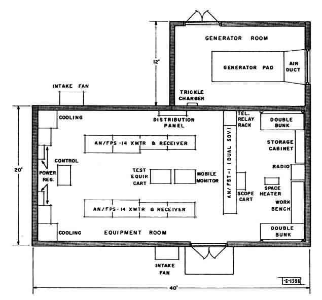
Typical floorplan
of a Gap Filler Annex
SITE NAME: Corn Springs
Gap Filler Annex (SM-162B)
LOCATION: Riverside County, California, approximately 40 miles
west of Blythe, California.
SITE HISTORY: This 0.30
acre site was obtained by DOD in 1957. The site was used as an
air defense command installation and assigned to Western Air
Defense Force effective March 1, 1959. It was retransferred to
the U.S. Department of the Interior on October 6, 1965.
Its mission was to cover
an area that was blocked from the MPS-7 and MPS-14 radars at
Vincent AFS/MCAS Yuma (SM-162) in Yuma, AZ. It was one of seven
planned Gap Filler Annexes (five activated) located in southeast
California and southwest Arizona assigned to that installation
and manned by members of the 864th Aircraft Warning Squadron.
The building was demolished.
Only the building's concrete pad and three radar-tower foundations/footings
remain.