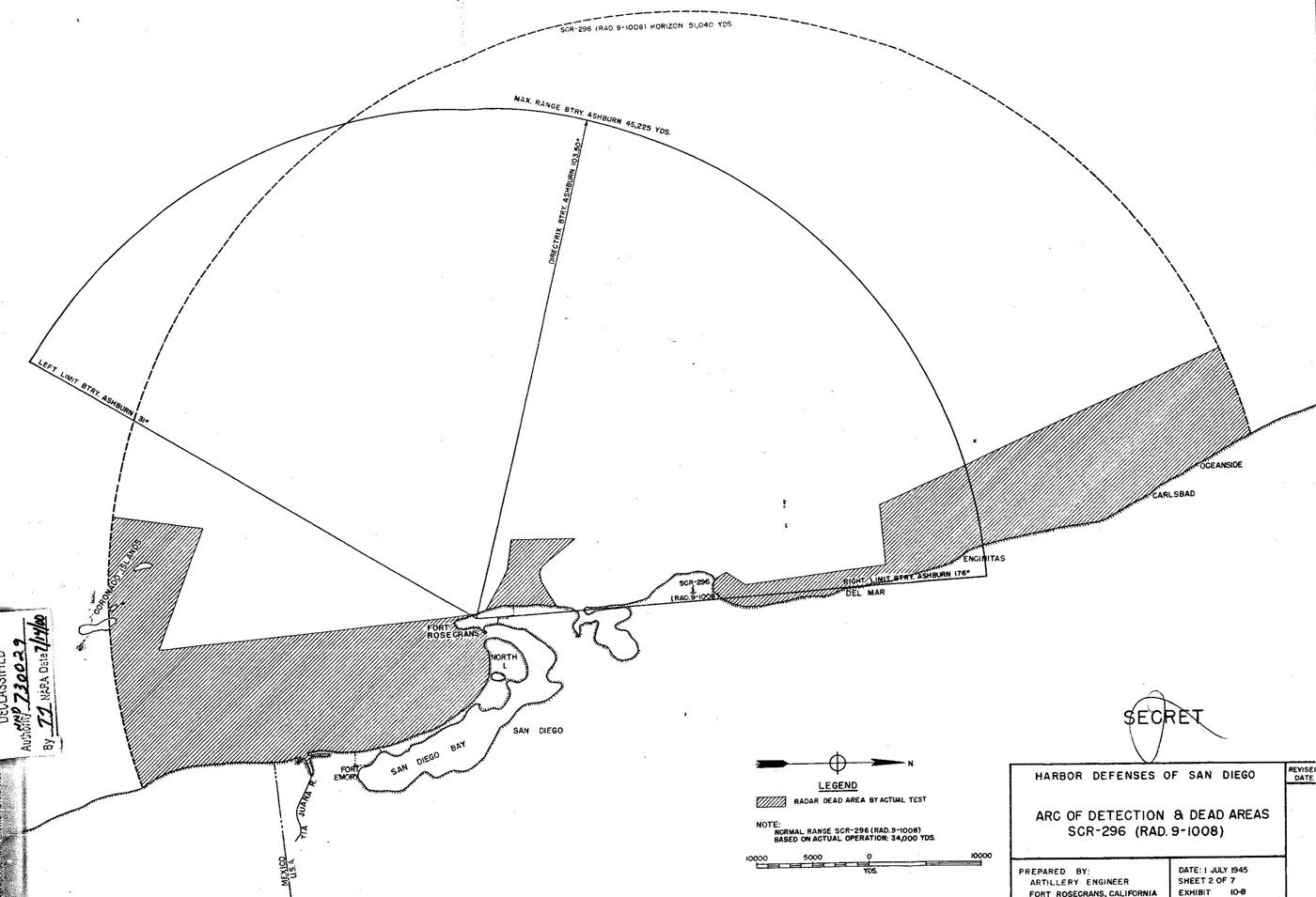
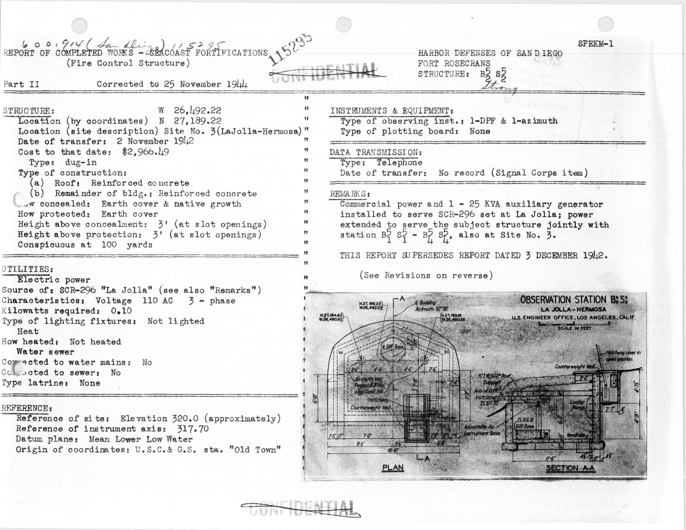
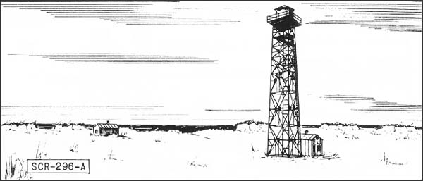
| Description: | Fixed Coast Artillery gun-laying medium wave radar, assigned to modern 6 inch or larger batteries. |
| Uses: | Set is designed to track a surface target in range and azimuth. Data are sent to the plotting room and used in firing. An SCR-296-A normally is assigned to one battery, but may furnish data to more. Works with IFF RC-136-A. |
| Performance & Sitting: | Range is shown on "A" scope. The target is tracked in azimuth with a pip matching oscilloscope or a zero-center meter. Range accuracy is about ± 30 yards while azimuth accuracy is about ± 0.20 degree under the best conditions. The set has a dependable range of 20,000 yards on a destroyer size target when employed at a height of 145 feet. Site should be not less than 100 feet above sea level; 150 to 500 feet is recommended. |
| Mobility: |
|
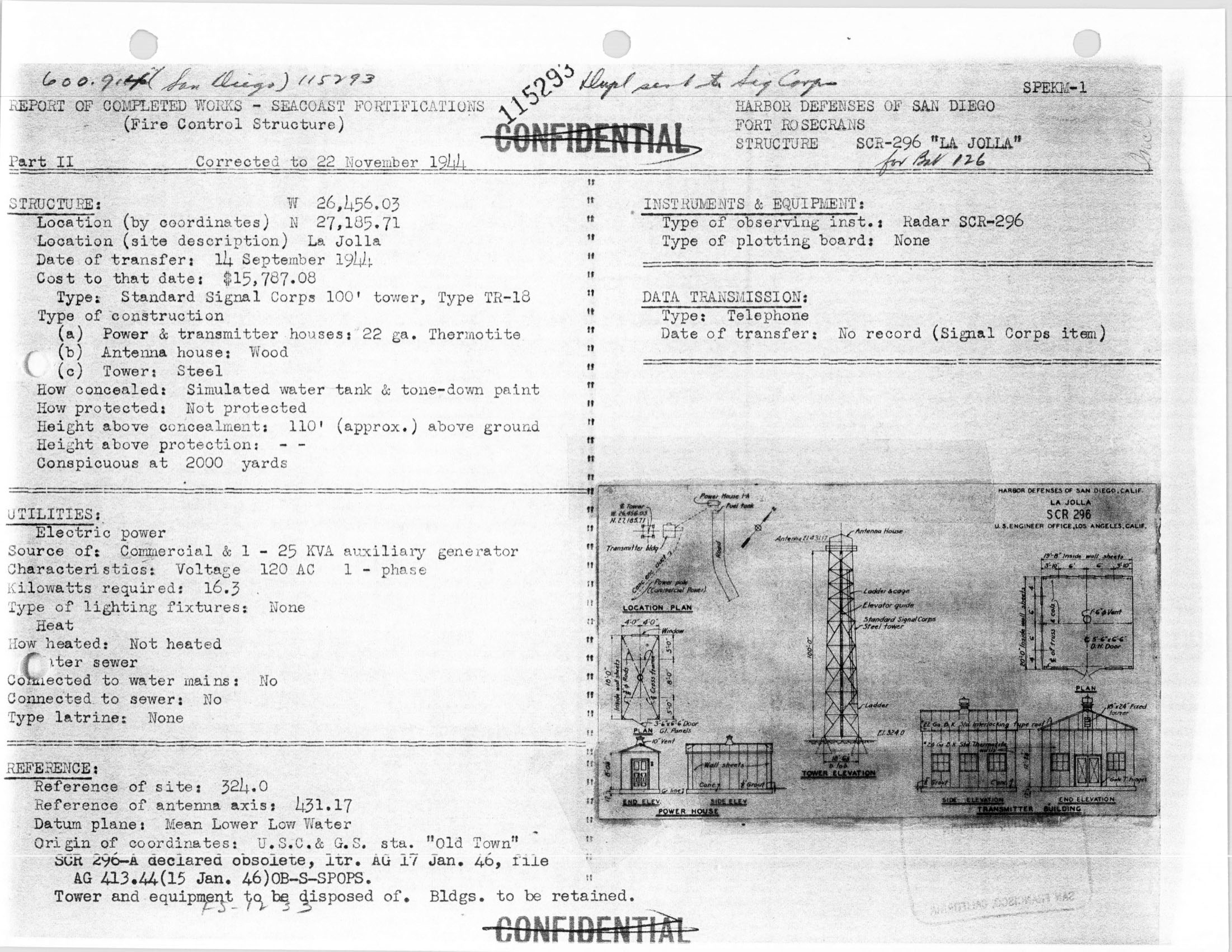
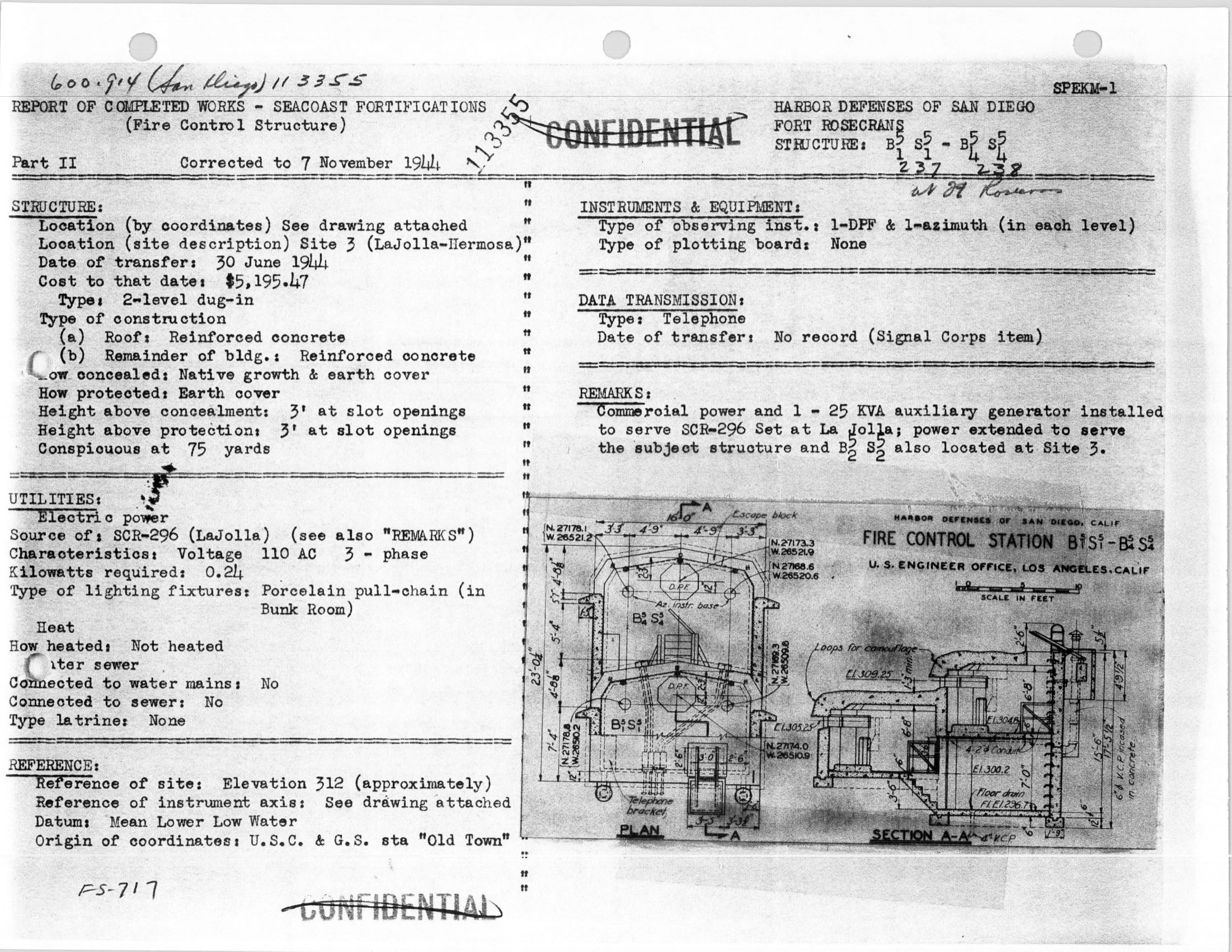
| Installation: | SCR-296-A includes a tower, an operating building, and two power plant buildings. The tower is obtainable in heights of 25, 50, 75, and 100 feet. Concrete floors must be put in locally. |
| Personnel: | Operating crew consists of 5 men in addition to a power plant operator and maintenance man who should be available at all times. |
| Power: | Primary power of 2.3 KW is supplied by PE-84C -- commercial or auxiliary 110 V, AC single phase. Generator needs high octane gasoline. |
|
Information from Naval History Library Online. |
For more information on the SCR-296 radar set CLICK HERE