| Altitude, feet | 1000 | 5000 | 20,000 | 25,000 |
| SCR-271-E Range, miles | 20 | 50 | 100 | 110 |
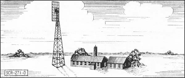
| SCR-271-D Range, miles | 25 | 60 | 120 | 135 |
Cambria Air Force Station is a closed United States Air Force General Surveillance Radar station. It is located 3 miles (4.8 km) south-southeast of Cambria, California. It was closed in 1980. During World War II, it was an air defense radar site operated by the Army Air Forces as part of the San Francisco Control Group.
Cambria AFS History
Cambria Air Force Station was one of twenty-eight stations built as part of the second segment of the Air Defense Command permanent radar network. Prompted by the start of the Korean War, on July 11, 1950, the Secretary of the Air Force asked the Secretary of Defense for approval to expedite construction of the permanent network. Receiving the Defense Secretary’s approval on July 21, the Air Force directed the Corps of Engineers to proceed with construction.
The 775th Aircraft Control and Warning Squadron was initially assigned to a temporary "Lashup" site (LP-2) that was established in November 1951 at Cambria equipped with an AN/TPS-1C radar. On 1 December 1953 the permanent station was activated with AN/FPS-3 search and AN/CPS-4 height-finder radars, replacing the earlier site, and initially the station functioned as a Ground-Control Intercept (GCI) and warning station. As a GCI station, the squadron's role was to guide interceptor aircraft toward unidentified intruders picked up on the unit's radar scopes.
In 1955 the height-finder radar was replaced by an AN/FPS-6. An AN/FPS-8 search radar also operated for a short time from 1955 to 1956. In 1959 the site featured two AN/FPS-3, and AN/FPS-6 and AN/FPS-6A radars. In 1961 the site received an AN/FPS-7 radar featuring ECCM capability. In 1961 the site also replaced the AN/FPS-6A height-finder radar with an AN/FPS-6B model. In April 1961 Cambria AFS joined the Semi Automatic Ground Environment (SAGE) system, feeding data to DC-17 at Norton AFB, California. After joining, the squadron was redesignated as the 775th Radar Squadron (SAGE) on 1 May 1961. The radar squadron provided information 24/7 the SAGE Direction Center where it was analyzed to determine range, direction altitude speed and whether or not aircraft were friendly or hostile.
In 1963 an AN/FPS-26A replaced the AN/FPS-6B height-finder radar, and continued routine radar surveillance throughout the 1960s and 1970s. Cambria AFS was re-designated as NORAD ID Z-2 on 31 July 1963.
In addition to the main facility, Cambria operated the AN/FPS-14 Gap Filler site:
Over the years, the equipment at the station was upgraded or modified to improve the efficiency and accuracy of the information gathered by the radars. In 1979 Cambria came under Tactical Air Command (TAC) jurisdiction with the inactivation of Aerospace Defense Command and the creation of ADTAC. Operations ceased on 30 September 1980 as a result of budget restrictions, and the general phase down of air defense radar stations.
Today, what was Cambria Air Force Station is in private hands. It was operated by the Coast Guard as a NAVTEX (Navigational Telex, broadcasting safety notices & weather info to ships) station. The station sold 1/13/05 for $2,000,000. Most buildings are in reasonable condition with most of the towers still remaining.
Air Force Units and Assignments
Units
Assignments
542d Aircraft Control and Warning Group,
7 March 1951
28th Air Division, 6 February 1952
27th Air Division, 1 October 1954
Los Angeles Air Defense Sector, 1 October 1959
27th Air Division, 1 April 1966
26th Air Division, 19 November 1969 - 30 September 1980
.
Source: Wikipedia
| Altitude, feet | 1000 | 5000 | 20,000 | 25,000 |
| SCR-271-E Range, miles | 20 | 50 | 100 | 110 |
| SCR-271-D Range, miles | 25 | 60 | 120 | 135 |